
About the Project
About the I-11 SafeTech Corridor Project
The Nevada Department of Transportation (NDOT) is advancing the I-11 SafeTech Corridor project, an intelligent transportation systems (ITS) initiative focused on improving real-time traffic operations, congestion management, and roadway safety along a heavily traveled portion of the Las Vegas valley.
Project Location
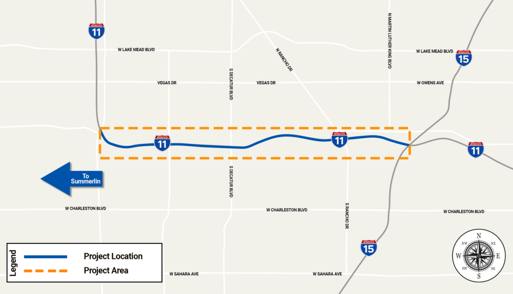
The project focuses on approximately five miles of I-11/U.S. 95 between Summerlin Parkway and the Spaghetti Bowl interchange.
Project Purpose
The I-11 SafeTech Corridor Project is designed to deploy and evaluate emerging transportation technologies that support:
Improved traffic flow & congestion management
Faster incident detection and response
Enhanced driver information systems
Wrong-way driver detection and warning capabilites
Expanded real-time traffic data collection & analysis
Future Active Traffic Management strategies in Southern Nevada
Learn more about the components being used to enhance the safety and traffic operations along the I-11 corridor.
Active Traffic Management (ATM) Gantries
The project includes the installation of advanced Active Traffic Management (ATM) gantries designed to provide real-time roadway information to drivers.
These gantries may support:
- Variable speed messaging
- Land use control
- Incident and congestion warnings
- Traffic condition messaging
Upon completion, the I-11 corridor will have 7 new ATM gantries installed.
The project has two types of ATM gantry installations planned:
- Two Type 1 Gantries
- Larger structures capable of displaying more roadway information
- Five Type 2 gantries
- Smaller structures with more focused messaging capabilities
Wrong-Way Driver (WWD) Alert Systems
The project includes the installation of 12 Wrong-Way Driver (WWD) Alert Systems throughout the corridor. The systems will help improve freeway safety and reduce the risk of wrong-way crashes.
While there are six primary interchange locations, each will include two wrong-way driver alert system installations, for a total of 12 systems throughout the corridor upon completion of the project.
How the System Works
- A wrong-way driver is detected at an off-ramp location equipped with a WWD Alert System
- Real-time alerts and camera feeds are transmitted to the valley’s Traffic Management Center (TMC)
- TMC operators verify the event
- Emergency responders and law enforcement are notified
- Active Traffic Management (ATM) signage may be activated to warn approaching motorists.
The regional Traffic Management Center is jointly staffed by RTC/FAST, NDOT, and Nevada State Police Dispatch.
Testing and calibration will occur following the completion of construction activities in the corridor.
Strategic Traffic Management Sites
The project also includes two Strategic Traffic Management Sites along the corridor.
These elevated pull-out locations are intended to support:
- Traffic incident management
- Special event operations
- Law enforcement monitoring
- Traffic enforcement activities
- Real-time data collection
- Corridor traffic management coordination
Planned Locations
- East of Jones Boulevard
- East of Valley View near the Springs Preserve
ITS Infrastructure Improvements
Additional ITS infrastructure and field equipment will be installed throughout the corridor to support:
- Communications systems integration
- Traffic monitoring capabilities
- Future operational technology deployment
- Coordination between NDOT, RTC/FAST, and the Nevada State Police
Stay Informed
Complete the form below to subscribe to receive project updates.